

This webpage shows the most relevant works on the geotechnical area
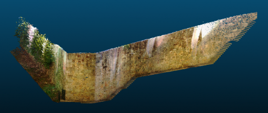
Laser scanning survey of a stone masonry retaining wall. This survey was used to support the identification of wall pathologies and identify the retains wall area that shows greater instability. Using the point cloud, a geometric model of the wall was generated.
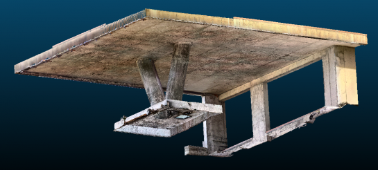
Laser scanning survey of a reinforced concrete slab. This survey was used to assess the structural safety of the slab, withdraw a geometric model and obtain the slab deformation. These results were then compared with the slab deformation obtained using a finite elements numerical model.
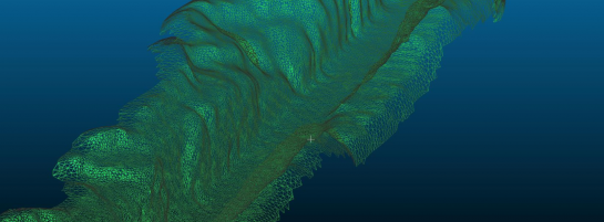
Monitoring of railway slope using laser scanning to obtain its geometrical information and calculate the volume of earthworks during its reinforcement. Point clouds obtained in different timelines were compared to detect some movements on the slopes and assess the path volume differences.
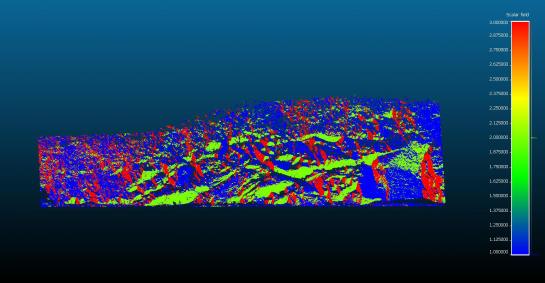
By using Lidar to scan a rock slope and obtain a 3D point cloud it was possible to automatically identified the main set of descontinuities . With these results further numerical analysis can be done, including kinematic analysis to identify the most probable mode of rupture. This type of identification, automatical and acurate, is a great alternative to the traditional geological survey that identified descontinuities sets manually.